

Getting to Puerto Peñasco is simple, especially if you are driving from Arizona. From either Phoenix or Tucson the trip down takes only about 4 hours (if you don't go more than 10mph above the speed limits).
BY CAR:
Besides using your own vehicle to get to Puerto Penasco, there are also several shuttle vans operating out of Phoenix and Tucson that make daily trips there. They will pretty much deliver you to the doorstep of your ultimate destination, and if you are nervous about driving in Mexico that might be the way to go for you. Note that while car rentals are available in Rocky Point, it can be expensive and you might not have a lot of choice.
Note also that if you drive into Mexico you MUST buy Mexican insurance. Your US car insurance will not cover you in Mexico, and if you are in an accident without insurance you will be in a world of hurt. There are many places along the road south where you can pick that up; the process is simple and inexpensive. Don't leave home without it.
If you don't want to take your own vehicle, or can't, some US car rental agencies will allow you to drive into Mexico, so you might want to check around to see what their policies are.
You will find detailed driving directions from Arizona and California below.
SPEED LIMITS:
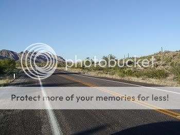
Obey the speed limits between Gila Bend and the border, especially around Ajo. The Ajo police have radar and they know how to use it. This is Hwy. 85 and because it is often pretty empty people have a tendency to go really fast, often drinking while they're driving. There have been many accidents on this road as a result, and this has encouraged an increased presence of Highway Patrol and local Police patrolling the highway.
Remember that once you enter Mexico the speed limit is posted in Kilometers per Hour, not Miles per Hour. The average speed limit between Sonoyta and Rocky Point is 90 Kilometers per Hour = 55.92 Miles per Hour. Almost no one obeys that speed limit, but as on AZ. Hwy. 85 you really have to watch for reckless drivers on this otherwise fine road. Keep your speed to a reasonable level and watch for a few sharp curves (and an occasional Mexican Highway Patrol car hiding out where you won't see it until it's too late).
The following might be helpful to you:
- 1 Kilometer per Hour = 0.62 Miles per Hour
- 35 Kilometers per Hour = 21.75 Miles per Hour
- 75 Kilometers per Hour = 46.60 Miles per Hour
- 120 Kilometers per Hour = 74.56 Miles per Hour
There are 2 airports in Puerto Penasco, the old one just outside of town which serves mainly smaller aircraft and is used by private pilots and charters, and a new international airport (the Mar de Cortés International Airport) about 20 miles south of town in the La Jolla de Cortez (Mayan Palace) area that is scheduled to open for real business in 2009. As of June 2009, there are no airlines offering regularly scheduled flights into the city, with the possible exception of Aéreo Calafia (sometimes erroneously spelled Aero Calafia) between Rocky Point and Hermosillo.
In the meantime, many people from out of the area choose to fly to Phoenix or Tucson and drive down from there.
For information about Crossing the Border-- what papers you'll need, what you can legally take with you (coming and going), taking your pets, etc., visit the BORDER CROSSING page (coming soon).
APPROXIMATE DRIVING DISTANCES:
Ajo, Az................. 94 miles Albuquerque,Nm......... 678 miles Caborca, Mx............ 108 miles Denver, Co ........... 1124 miles Farmington, Ut......... 925 miles Guaymas, Mx.............345 miles Hermosillo, Mx..........270 miles Las Vegas, Nv...........514 miles Los Angeles, Ca.........425 miles (Going thru Gila Bend, etc.) Los Angeles, Ca.........550 miles (Going south thru Yuma, etc.) Lukeville, Az ...........68 miles Nogales, Mx ............294 miles Phoenix, Az ............215 miles (Taking the 85 through Gila Bend, etc.) San Carlos,Mx...........357 miles San Diego, Ca ..........445 miles (Going thru Gila Bend, etc.) San Diego, Ca ..........350 miles (Going east thru Yuma, etc.) San Francisco, Ca.......927 miles Salt Lake City, Ut .....890 miles Sonoyta, Mx .............66 miles Tucson, Az .............216 miles Yuma, Az ...............150 miles (Via the new coastal highway [Sonora Hwy 003]Note: Once you have crossed the U.S./Mexican border you'll be in the Mexican town of Sonoyta. Stay to the right and you will see signs which direct you through town to Puerto Penasco. Just keep a lookout for them. They will place you on Mexico Route 8 and an almost straight run to Puerto Penasco. There are a few sharp turns though so stay alert DON'T DRIVE AT NIGHT.
Within Sonoyta the speed limits are S.L.O.W. Mostly it is 40 kph (25mph) but in places it is 20kph (12mph!)-- and in those places there is usually a traffic cop hanging around just waiting to bust you for speeding. Radar is also used to enforce the speed limits, seemingly aimed primarily at gringos who tend to speed through town in their pickups and SUVs. So the best advice is to obey the speed limit even when the drivers behind you get really mad; on more than one occasion such a driver has ended up grateful as someone else speeding past got pulled over. See the "Speed Limits" note further up in this post.
DIRECTIONS FROM PHOENIX:
Take the I-10 West out of Phoenix to State Highway 85 South. Follow 85 through the towns of Gila Bend, Ajo and Why until you reach the Mexican Border at Lukeville, which is your last chance to stock up on anything you've forgotten before entering Mexico. You will see the border there, and crossing is usually a piece of cake. Remember that the border is closed from 10:00PM to 6:00AM.
DIRECTIONS FROM TUCSON
In Tucson you have 3 main options. Pick up Valencia Road heading West (this is the largest major street in Tucson); Valencia will become State Highway 86 - still heading West- and you will stay on 86. Or you can take Ajo Way or I-19 (Ajo Exit), also heading West, to Hwy 86. Once on Highway 86 continue West through the tiny towns of Sells and Quijotoa on the Papago/Tohono O'Odham Indian Reservation to the town of Why. At Why turn left onto State Highway 85 South. Follow Highway 85 South to Lukeville, which is your last chance to stock up on anything you've forgotten before entering Mexico. You will see the border there, and crossing is usually a piece of cake. Remember that the border is closed from 10:00PM to 6:00AM.
DIRECTIONS FROM LOS ANGELES
From L.A. you have two choices. The original (and longer) route is to take Interstate Highway 10 East to the Arizona town of Buckeye, then turn south on State Highway 85 through the towns of Gila Bend, Ajo and Why until you reach Lukeville at the Mexican border.
The new shorter route is to take US-101 South and East to Yuma, AZ. Keep left to merge onto the San Bernardino Freeway toward San Bernardino. That FWY becomes I-10 E. Stay to the right to take CA-86 SPUR S via EXIT 145 toward CA-86 S EXPRESSWAY/BRAWLEY/EL CENTRO. CA-86 SPUR S becomes CA-86 S. Stay STRAIGHT to go onto E MAIN ST/CA-78. Continue to follow CA-78 until you see the sign for CA-111 S. Turn RIGHT onto CA-111 S. Merge onto I-8 E toward YUMA (Crossing into ARIZONA). Take the US-95/16TH ST exit, EXIT 2. Turn RIGHT onto US-95/E 16TH ST. Turn LEFT onto US-95. Turn LEFT onto URTUZUASTEGUI ST. (Don't worry, you'll see signs directing you to San Luis, AZ and to Mexico; just follow them.)
This will put you in busy little San Luis, AZ, which is where you will cross the border into Mexico at San Luis Rio Colorado. From the border, follow the signs toward El Golfo de Santa Clara (a small town 70 miles south on the northernmost point of the Sea of Cortez, at its confluence with the Colorado River.) In El Golfo, follow the signs to Puerto Penasco. You will be on Sonora State Hwy 003, a new and excellent road.
Alternately there is a new toll road out of San Luis that will shave about half an hour off your trip, but it will cost you 94 pesos. As you are leaving town you will turn south onto Hwy SON 197. The toll booth is at Estacion Doctor (your last chance for bathrooms for awhile). This is a new 2-lane highway; it is fast and straight and will take you eventually to some railroad tracks. After you cross the tracks you will make a left turn onto Hwy SON 003. Driving along on 003, you will pass some odd looking "igloo"-type buildings. Shortly after that you will come to a turnoff where you can choose left for Puerto Penasco or go straight for El Golfo. The choice is yours. Heading left for Rocky Point (still on Hwy 003, the new Coastal Highway), you will find a couple of nice Ecology Stations along the way and they are worth a stop. In addition, at tiny El Solito (you can't miss seeing it) you can stretch your legs and get a cold drink and a little something to snack on if you're not in too big a hurry. Not long after El Solito you will turn left at another well-marked intersection, which will take you to the main highway into Rocky Point(you're almost there!). At the next intersection, turn right into the traffic and you are now at the outskirts of town.
Stock up on anything you may have forgotten in San Luis, and top off your gas tank, in San Luis Rio Colorado (where gas is cheaper). Beyond El Golfo there are few amenities and it's about 85 miles to Puerto Penasco from there. Bring your camera, there are some nice photo ops along the way.
DIRECTIONS FROM SAN DIEGO:
The original, and longer, route is to take Interstate Highway 8 East through the Arizona bordertown of Yuma, to the town of Gila Bend. At Gila Bend turn south on State Highway 85 through the towns of Ajo and Why until you reach Lukeville at the Mexican border.
The new shorter route is to Take Interstate Highway 8 East to Yuma. Approaching Yuma, take the US-95/16TH ST exit, EXIT 2. Turn RIGHT onto US-95/E 16TH ST. Turn LEFT onto US-95. Turn LEFT onto URTUZUASTEGUI ST. (Don't worry, you'll see signs directing you to San Luis, AZ and to Mexico; just follow them.)
This will put you in busy little San Luis, AZ, which is where you will cross the border into Mexico at San Luis Rio Colorado. From the border, follow the signs toward El Golfo de Santa Clara (a small town 70 miles south on the northernmost point of the Sea of Cortez, at its confluence with the Colorado River.) In El Golfo, follow the signs to Puerto Penasco. You will be on Sonora State Hwy 003, a new and excellent road. From there, follow the instructions given in the Los Angeles section just above.
Stock up on anything you may have forgotten in San Luis, and top off your gas tank, in San Luis Rio Colorado (where gas is cheaper). Beyond El Golfo there are few amenities and it's about 85 miles to Puerto Penasco from there. Bring your camera, there are some nice photo ops along the way.
Whew! It took longer to write this all out than it does to get to Puerto Penasco. Come on down!